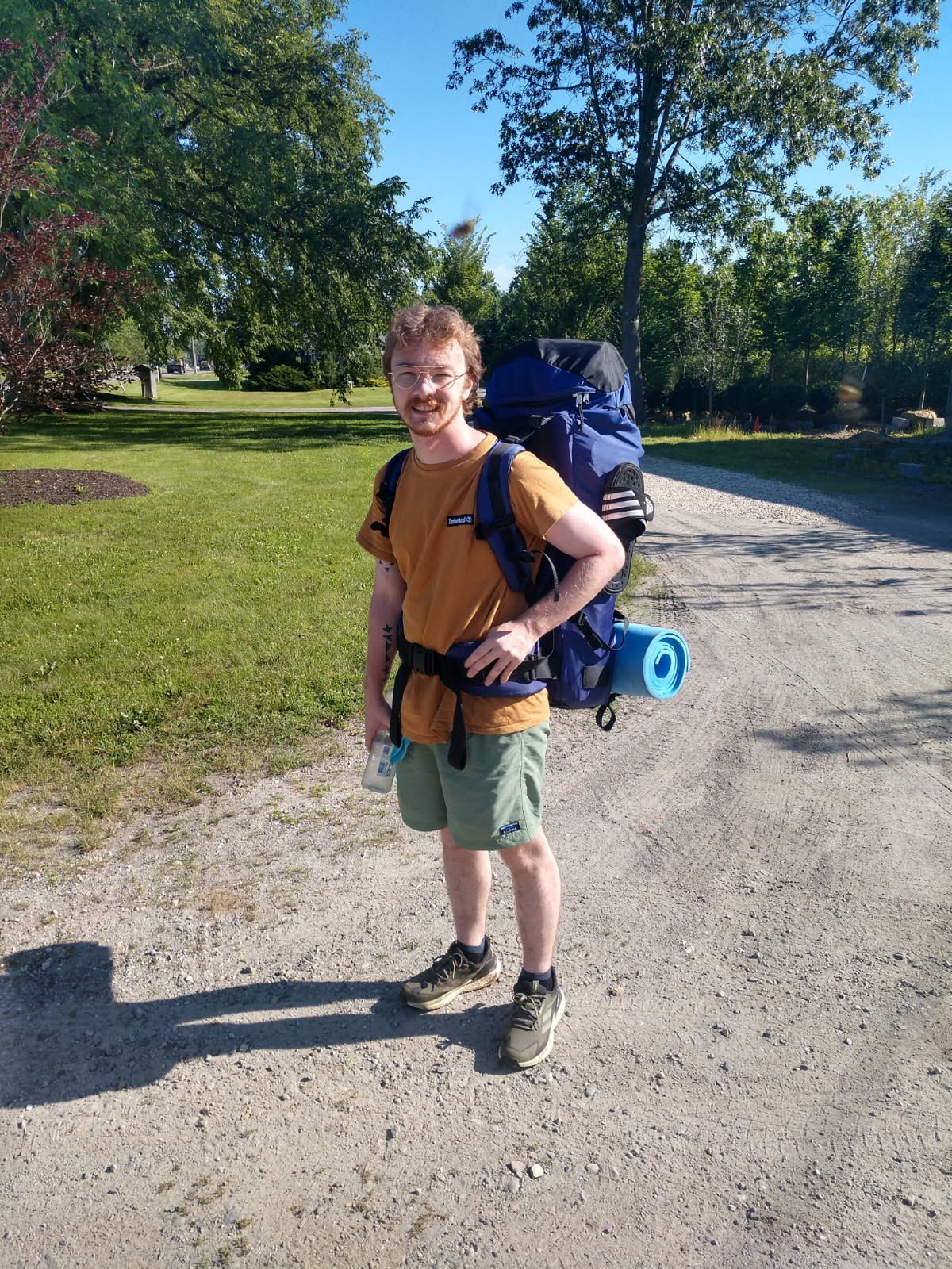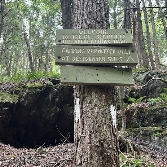
Last week, I completed a section hike of the Appalachian Trail which took me from North Adams, on the Vermont border of Massachusetts, down to Salisbury, on the Massachusetts border of Connecticut. This covers about 105 miles of trail and is particularly hilly, though not nearly as elevated as other parts of the trail. I'm writing this for the clarity and interest of those who have been curious about what I've been doing along the way. But before I discuss the trip itself, here is a little about my gear.
Gear
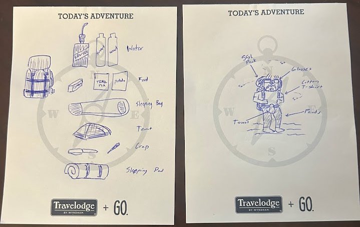
As seen from my beautiful drawing on the Travelodge notepad, I did in fact bring gear. This was my first major trip and I definitely overpacked, so I'll go over some staples, and some stuff that was useless.
The trifecta of sleeping pad, sleeping bag, tent, are some of the most
important components of your bag, and interestingly the most varied
among hikers. My set-up is VERY budget friendly, so compared to the
regular Zpacks and Big Agnes Andys on the trail, I was hauling weight.
My
sleeping bag
and
tent
are both REI, and my pad is the cheapest piece of foam on Amazon. I'm
not even linking it because I've already replaced it. My sleeping pad
was held on the outside of my pack. It got so, so dirty. Definitely
pick up something with a cover. Foam is really hard to clean.
Curiously, my pack is also REI, but I bought it off of an old dude on
marketplace for 50 bucks. It's super old, and lacks a lot of the
fanciness of modern packs. There's no where to put a water bottle,
except inside the pack or in your hand. The belts can be hard to
tighten, as can the cinches. It's also pretty heavy. But it looks
cool.
For my water filter I went with the
Sawyer Squeeze. I was treated with a weird kind of respect on the trail for using
my original pouches that came with the Sawyer, which people tend to
worry will break on them (remember this). I found the Sawyer to be
great, and I got used to the taste of water really fast. When I
started, I actually drank water directly out of the filter, rather
than putting it in a water bottle first. The technique was a little
ridiculous, as I had to lift the bag over my head everytime I wanted
to drink. I, at best, looked like a hydrated idiot.
My pack ended up being about 33 pounds with food. This comes out to be
somewhat average for hikers, but I could definitely get down to 30 by
scrapping some useless stuff. I carried around a shovel for the entire
time, and only used it once, and brought some pretty sponge-like
clothes. Shoot for 30, if it's your first trip.
A quick aside before jumping off of gear, just to talk about stuff I
wish I had. First, a pillow would be nice, I've heard good things
about a couple brands, particularly the
Nemo Fillo
and the
Thermarest Compressible. I've never actually tried out a camp pillow, so I have to do that
to figure out if they're worth it, but my hope is that they feel good.
I also found myself jealous of other people's bags regularly, so I'll
be looking into ways to modify my current one to better suit my needs.
First Days
Turns out, backpacking while unprepared is actually pretty hard. I
gave myself a period of about two weeks to train, and went for day
hikes of around five miles every other day. This was not enough. When
I got about half a mile in, I knew that I was going to quit before the day was over.
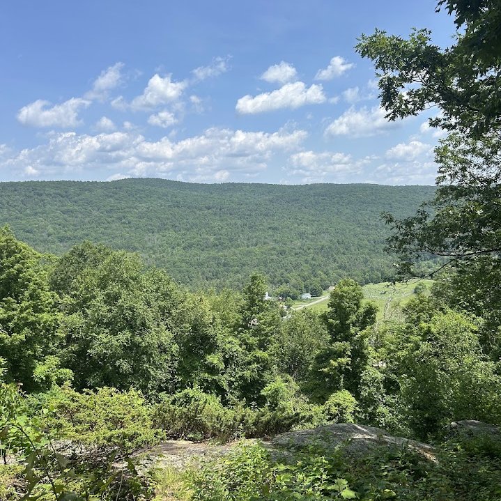
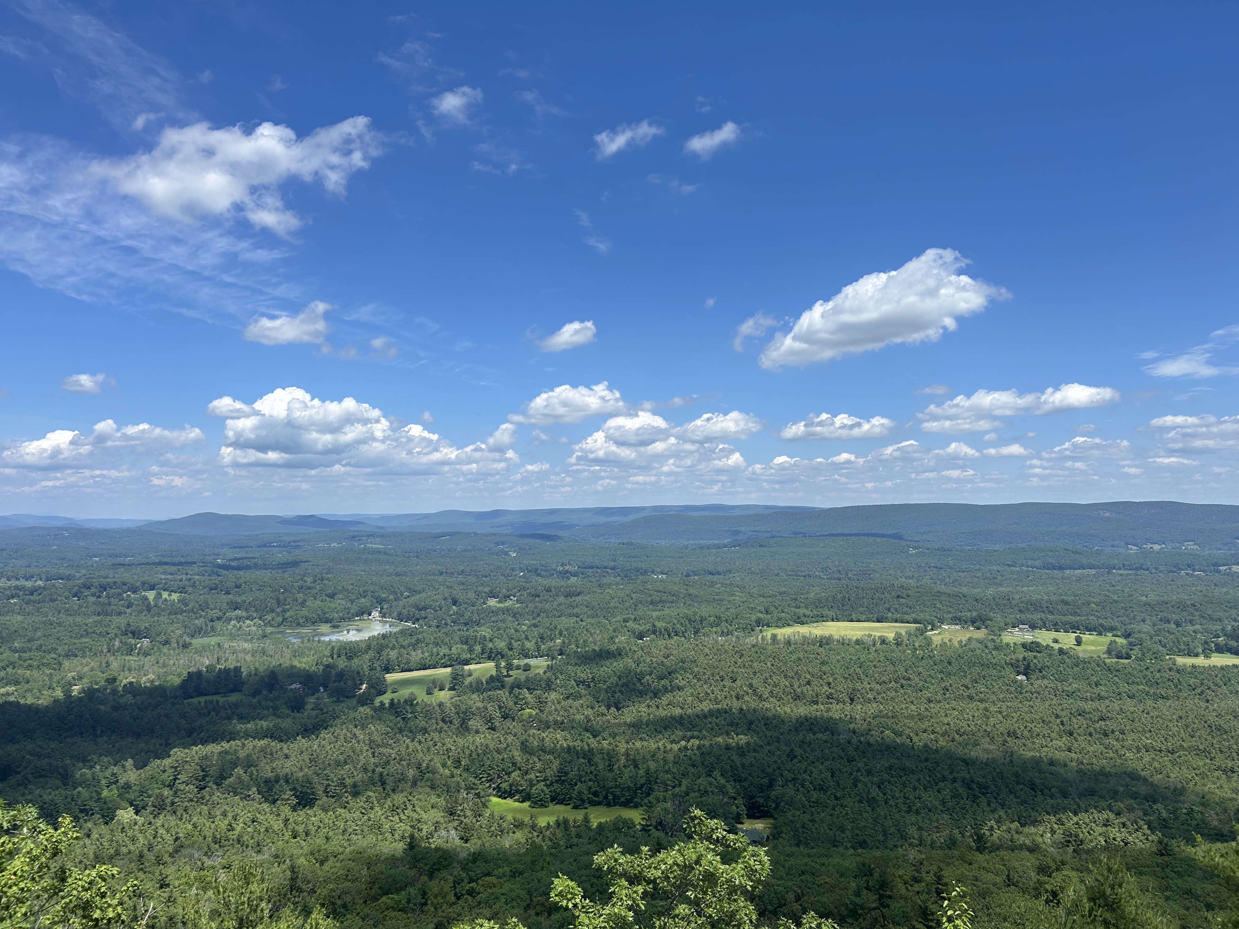
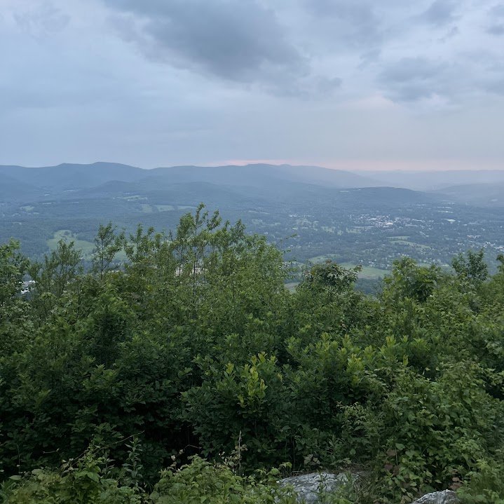
The first day was particularly hard. I travelled about ten miles (more
than I had ever hiked ever, probably), and got up to a ledge on
Prospect (seen above). Following this, I went twenty minutes in the
wrong direction, and ended up getting to camp at around 9PM. Whoops.
This was by far my quietest day. It seems the bubble of hikers from
Springer had not reached my area yet, and I wouldn't see hikers in
droves until a little under a week in, when I would reach Upper Goose
Pond.
After the first day I woke up to rain. This weather would make day two
end very short. I travelled a little over four miles. I have a lot of
excuses for this, I swear. First, yesterday was a lot of mileage for
someone as out of shape as me. Second, this was Williams and Greylock,
the highest elevation in Massachusetts. Third, it was pouring. Fourth, I was scareddddd. Along
the way, I would meet a few people. First was two old women who gave
me some water and a hard boiled egg. Thanks! Second was a guy who I
had seen doing a day hike the day prior, and would see day hiking on
day 3 as well, which was odd. Third was my first hiker-hiker, named No
Filter.
No Filter and I met at the emergency shelter at the top of Greylock.
He was in his 50s, and from Malden (which he didn't need to tell me, I
knew). We both got stuck at the top of Greylock, because the rain was
too hard to safely get down. In an attempt to make the most of it, we
started a fire in the fireplace in the emergency shelter. No Filter
may well have been a wizard, because I swear the wood was wet when I
got in there. At this point, we also found toilet paper and vodka very
handy. For fire, not for food and drink. The fire raised the
temperatures in the shelter just enough to almost dry my wet clothes.
Greylock was very complicated for me. For a lot of people, it's the
highlight of Massachusetts, for me, it kind of blew. When I got to the
top, I was relieved and excited to get to the lodge, only to find out
it was closed, which is how me and No Filter ended up in the emergency
shelter. We made the most of it, but Greylock's characteristic views
couldn't be seen. The best part was the next morning, when the lodge
opened and they served breakfast, which was great and cheap. There, I
would meet my first thru hiker, Kaleidoscope. He was crazy, telling us
about his consistent 25-30 mile days. He was a few days ahead of the
rest of the bubble, so it was clear that his mileage was adding up. I
would also go on to see him in every subsequent hiker log I checked
going southbound. He signs his name in rainbow pen.
It was also on Greylock where I would recieve my trail name, after the
previously mentioned old women and No Filter seperately suggested that
the location I hold my towel (see drawing above) was reminiscent of a
sumo wrestler. Hence the name: Sumo.
Leaving Greylock about a mile in, I cramped my knee, really bad. I was
able to limp about half of a mile to a street. Luckily, there is a
large network of shuttle drivers in the Berkshires ready to pick you
up within an hour. I got picked up by Cindy, an old woman driving a
Subaru with a busted manifold, who was still managing to go 60 in a
30. She dropped me off where I would camp next, so I effectively
missed about five miles of the trail from Greylock to Cheshire. She,
along with all of the shuttle drivers I would go on to meet, are
experts in the surrounding area, both in regards to hiking, as well as
everything else. If you needed any kind of item, they could take you
to where it is sold.
Father Tom's Campsite, where I spent the remainder of day three, was a
very nice campsite situated in the center of the puny town of
Cheshire. Cheshire has three attractions, a gas station, a Dollar
General, and a restaurant. The campsite, kept together by a local
church, had several amenities, including bikes. I'm confident the bike
fixed my knee. I could barely walk so I biked everywhere, and biked
for leisure. It was a lot of fun.
I also ate at a restaurant! This quickly became one of my favorite
things on the trail (some dedicated hikers hate it). Stopping and
eating is incredibly satisfying here, because every calorie counts,
and you get to experience a little bit of local life. It was here I
made a habit of getting a beer in every town I'm in.
Dalton and Beyond
After a bit of hiking and a brief stop at Crystal Mountain campsite, I had made it to Dalton without any major issues. Dalton is sick. I somehow came out of town spending twenty dollars, after getting a burger, fries, two beers, two Smartwaters, some chips, and ice cream. I don't know how this happened. I unfortunately missed a legend, Tom Levardi, who is a notorious Trail Angel whose house is on the trail. He was out to lunch. I did, however, meet a group at the bar, who were headed up to Vermont that day (!!), about a 25 mile distance, at 2PM. I don't get how some do it.
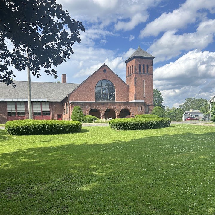
Dalton is an excellent town. There's a really cool church, a dam,
many, many gas stations. Basically, everything a hiker needs. I made
the mistake of only doing a small restock here, although I did restock
prior in Cheshire. I just got what seemed good, which meant I only had
about three days of food.
This would be where I abandoned my drinking technique. This is because
I found one of my squeeze bags had a hole in it (I told you to
remember). This meant that at this point I would've only been able to
carry one liter on me at all times. I ended up joining the horde of
hikers who use Smart Water bottles. They're really handy. I don't know
what I was thinking the first few days just slamming down Sawyer straw
water.
Leaving Dalton, I had another three miles before the next campsite,
Kay Wood. This was surprisingly tame. Suprisingly, only because this
was the day that I walked the most, at about nineteen miles. I felt
very good! Until the following day. That day, I got in about nine
miles, which was my average. My feet were killing me. My feet are
still killing me, and its been over ten days. Since I've finished,
I've been walking like I just learned how to. In any event, I
traversed Warner Hill. I was so worn out I didn't even stop to take a
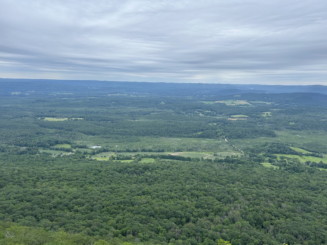
picture! So no picture! Imagine Warner Hill!
The best part of this day was that I was able to ask a passing hiker
for Ibuprofen, and he gave me some. It helped a lot. There is an
endless amount of kindness on the AT. If you ask a hiker for
something, there's a very high chance you'll get it. The people of the
Berkshires love hikers. Many, affectionately called Trail Angels, will
bring supplies to the trail for hikers to take. It varies from beer to
painkillers to burgers. The wilderness is a calorie desert for a group
of ravenously hungry people, and Trail Angels supplement that.
On the topic of Trail Angels, I finished this day at the house of the
Cookie Lady. The Cookie Lady got her name from giving free cookies and
tea to all hikers who come by her house. She provides other amendities
as well, like a bathroom, water, shelter. I ended up staying at her
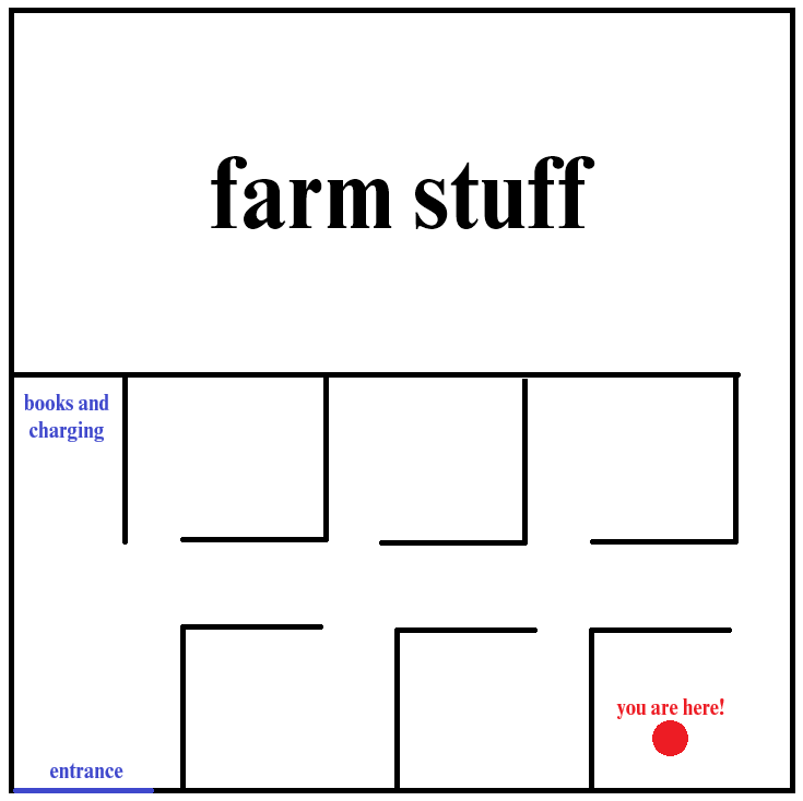
place, in an airplane hangar where they keep farm equipment. I didn't
get a picture of the layout of the hangar, but I'll provide a picture.
It was six "bedrooms," seperated by cubicle dividers. There were no
overhead lights, so it was constantly dark and I had to equip my
headlamp. It also had the distinct smell of hikers. The beds were not
for sleeping in, rather they were for sleeping on. I put
my sleeping pad and bag on top of the bed. It was comfortable, but I
missed beds.
A few more things about the Cookie Lady: She had two dogs, who chilled
out on the farm. If you couldn't make a donation, you could work on
the farm for a day to earn your bed. She told me to look out for a man
named Hawk, who had done the trail eight times, and was shooting for
ten.
I left at around 7AM. This meant that I narrowly missed
The World's Fastest Hiker
My trip coincided with the world record attempt for the fastest known
time (or, FKT) of the Appalachian Trail. It was being attempted by a
gentleman named
John Kelly, a data scientist. At this point, he had been hiking for about 25
days, and had gone 1550 miles.
John Kelly is a speciman among specimen. For one, he was consistently
doing 50 mile days on the trail. On top of this, he was only sleeping
three hours a night. He is, in all respects, a machine that turns
resolve into mileage. We talked a lot about John Kelly on the trail.
Everyone was following him. If you needed to start a
conversation over camp dinner, he was the easiest pick. A lot of the
conversations boiled down to how much respect everyone has for Tara
Dower, the current record holder.
The controversial part of John Kelly is the amount of support he has.
He consistently has two pacers, he slackpacks (or, has his bag
delivered to the next campsite every day), and he seems to have the
entire universe on his side. Of course, this was the case for Tara,
but John seems to have some sort of technlogical edge to him.
Unfortunately, as of writing this, John Kelly sustained an injury to
his ankle and has abandoned the attempt. Personally, I was
indifferent, but a lot of hikers have varying opinions about his run,
and whether or not they wanted Tara to keep the record. A John Kelly
record would certainly open the gates for other runners to challenge
the record, which would've been really cool to see. Though, I get the
feeling he is far from done with this.
Brady Norum Takes a Break
After leaving the Cookie Lady's house, I hustled a good distance
because I was truly excited for my next stopping point, Upper Goose
Pond. This site is famous for having a federally-owned cabin run by
volunteers who serve pancakes and coffee in the morning. To get there,
I had to cross Becket Mountain, as well as make my way around a lake
or two. Neither was particularly bad, but I think I ended up leaving a
water bottle on Becket. Whoops.
Also on Becket, I got a minor spoiler for the rest of my journey. At
the summit, I met two people, who happened to be the cabin volunteers.
They told me to go slow, because we were on our way to the same place,
and they had to unlock the cabin. They didn't need to tell me. My
slowness is completely self-imposed. Going down Becket was nice,
because I knew it would be the last elevation change before Upper
Goose Pond.
The end of Becket coincided with my exact half-way point on the trail,
which was the Massachusetts Turnpike, Interstate-90. This route runs
directly through the center of Massachusetts, which means it was at
about the 48 mile mark. Following I-90, it turns out I had to go up
again. Always check your topographic map. There is a nature boundary
which is a couple hundred steep feet which you go up, then immediately
down.
It wasn't too bad (this is a lie). After this, it was a quick walk to
Upper Goose Pond. There, I would meet several thru hikers. Among
them were Nature Boy, Metro, Alpha-Gal, and an old Scottish dude that
I never got the name of. There were tons of people here, about two
dozen. I slept in my tent rather than the cabin, because the next
three days were the hottest of the year, and there is no AC in the
remote cabin. The Feds can pay for pancakes, but not air conditioning.
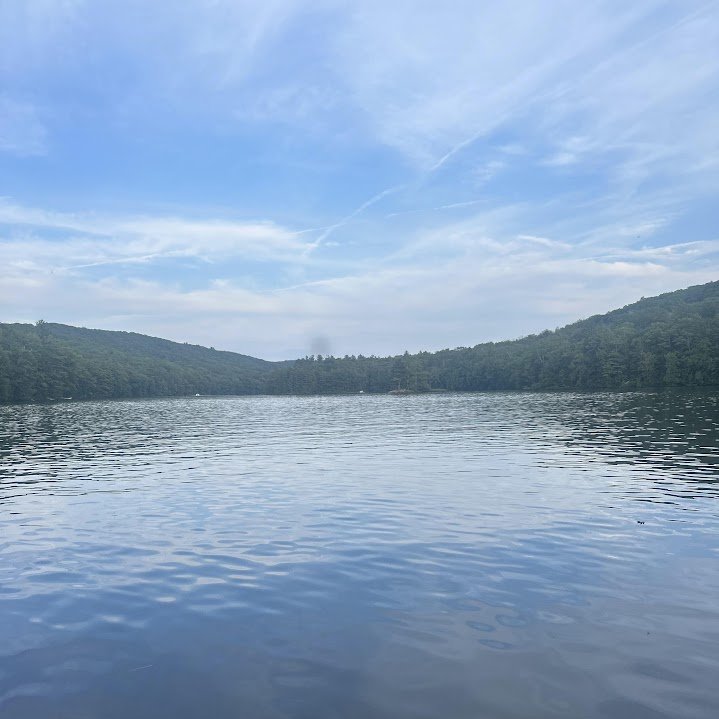
On top of enjoying the boons of the cabin and the company of the
others, I took a swim. One thing I've left out so far is how dirty I
was. I brought baby wipes in an attempt to keep myself clean, but it
only goes so far. Swimming in the lake was as clean as I could get for
now.